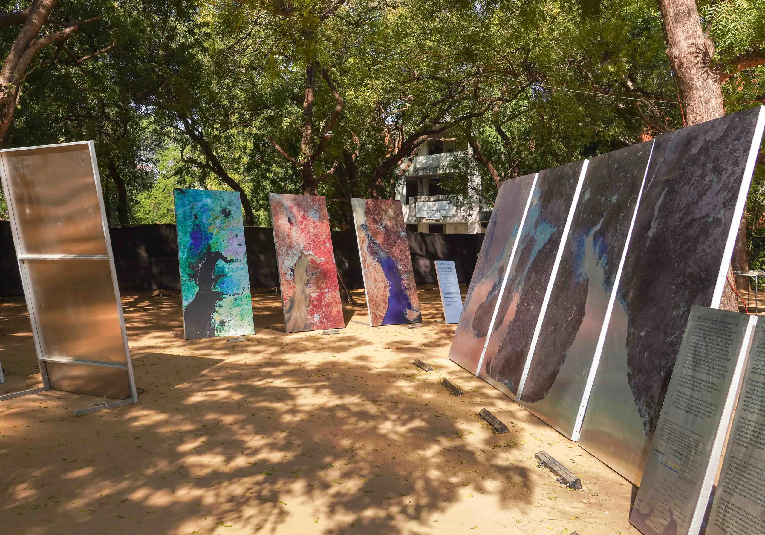
Turbulent Displacements - An exhibition
Research Exhibit at Abhivyakti 2022
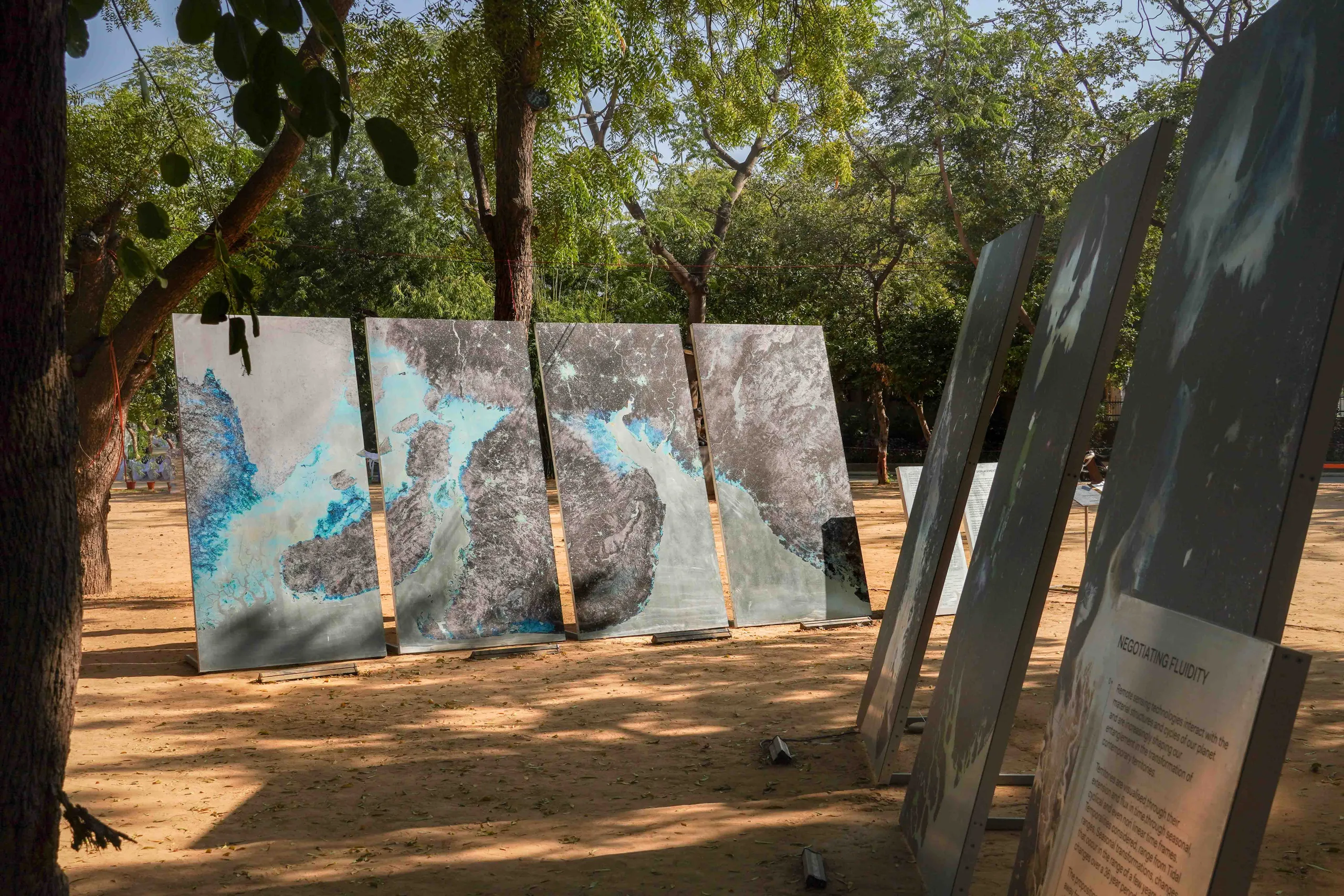
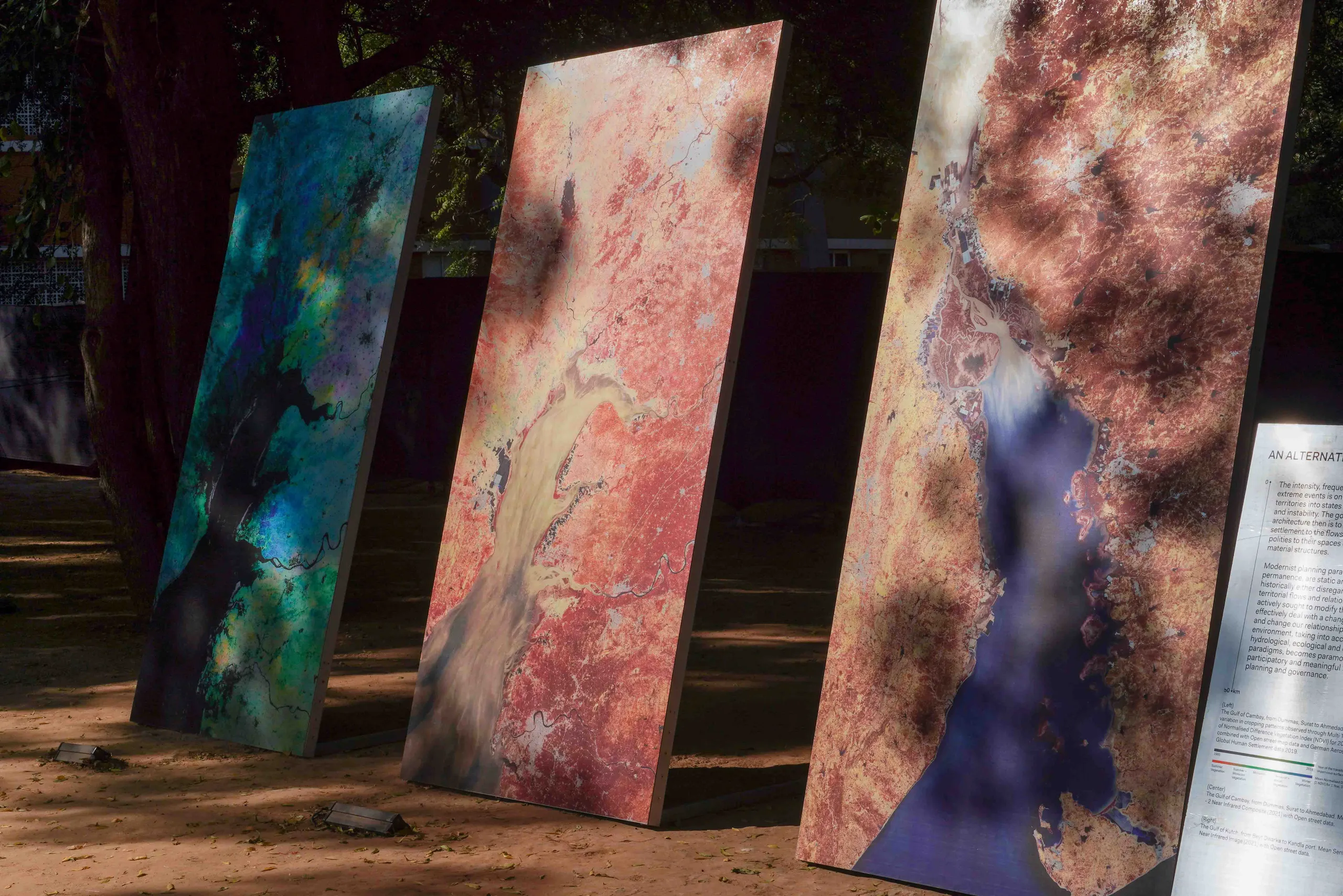
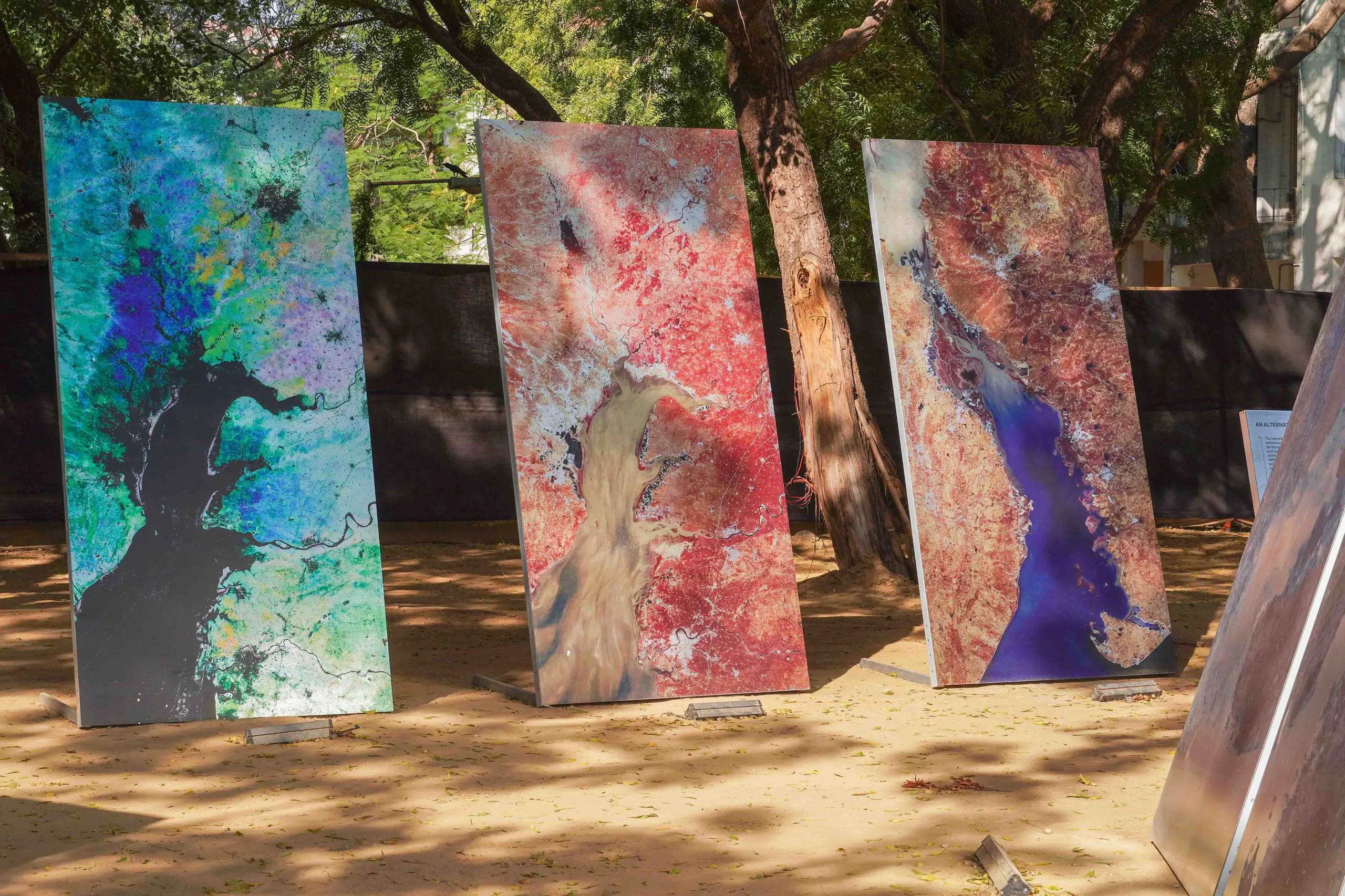
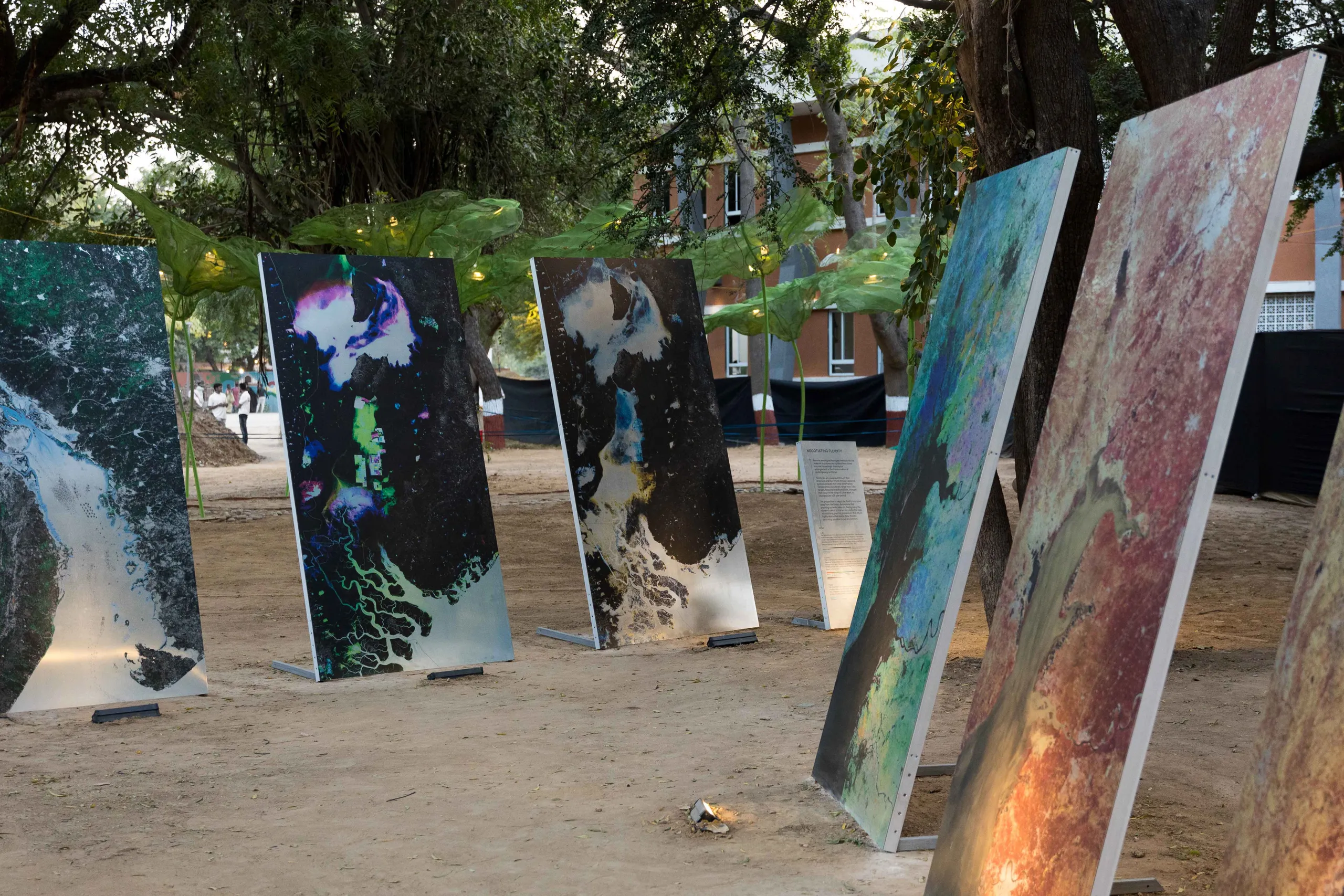
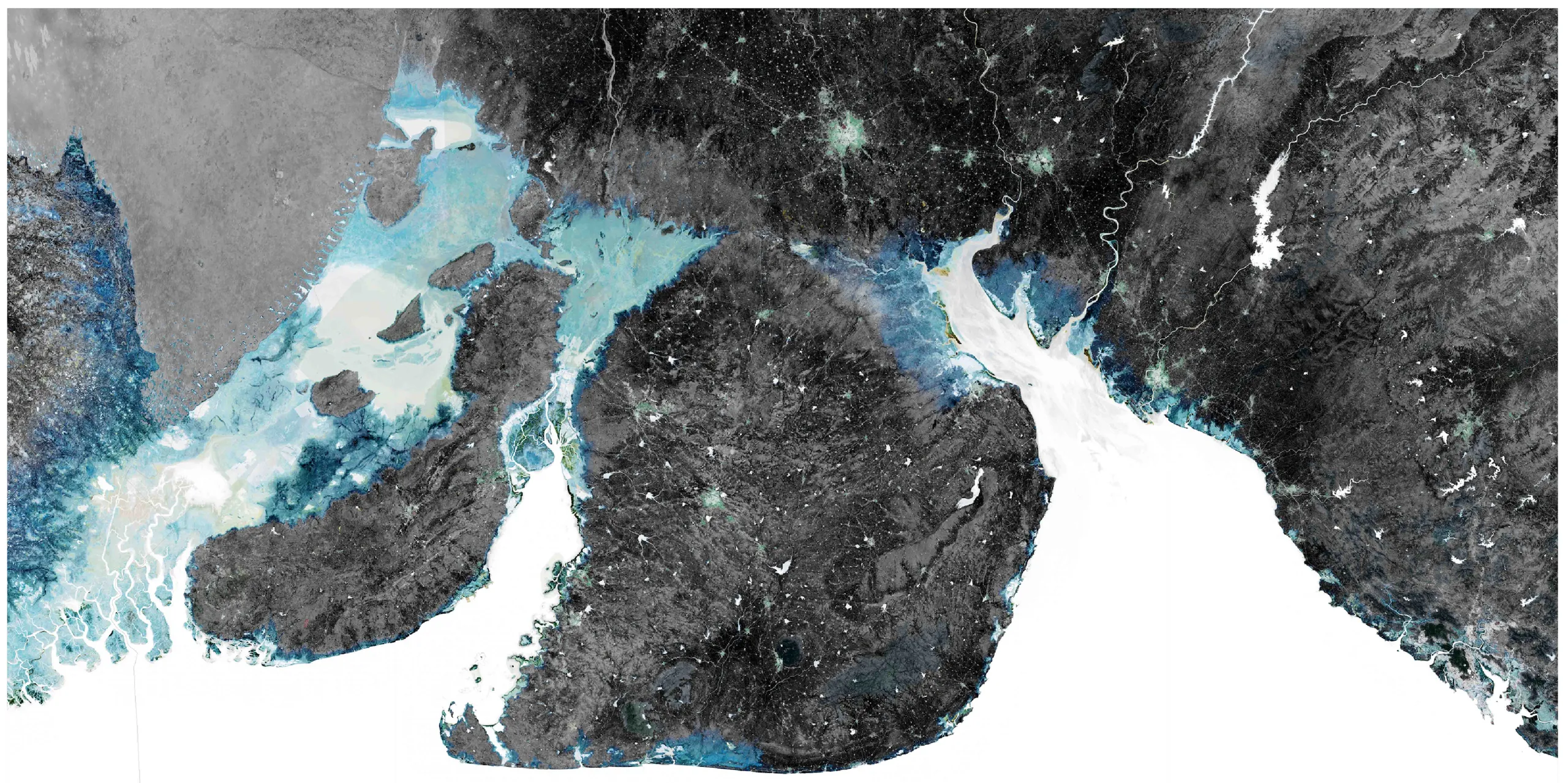
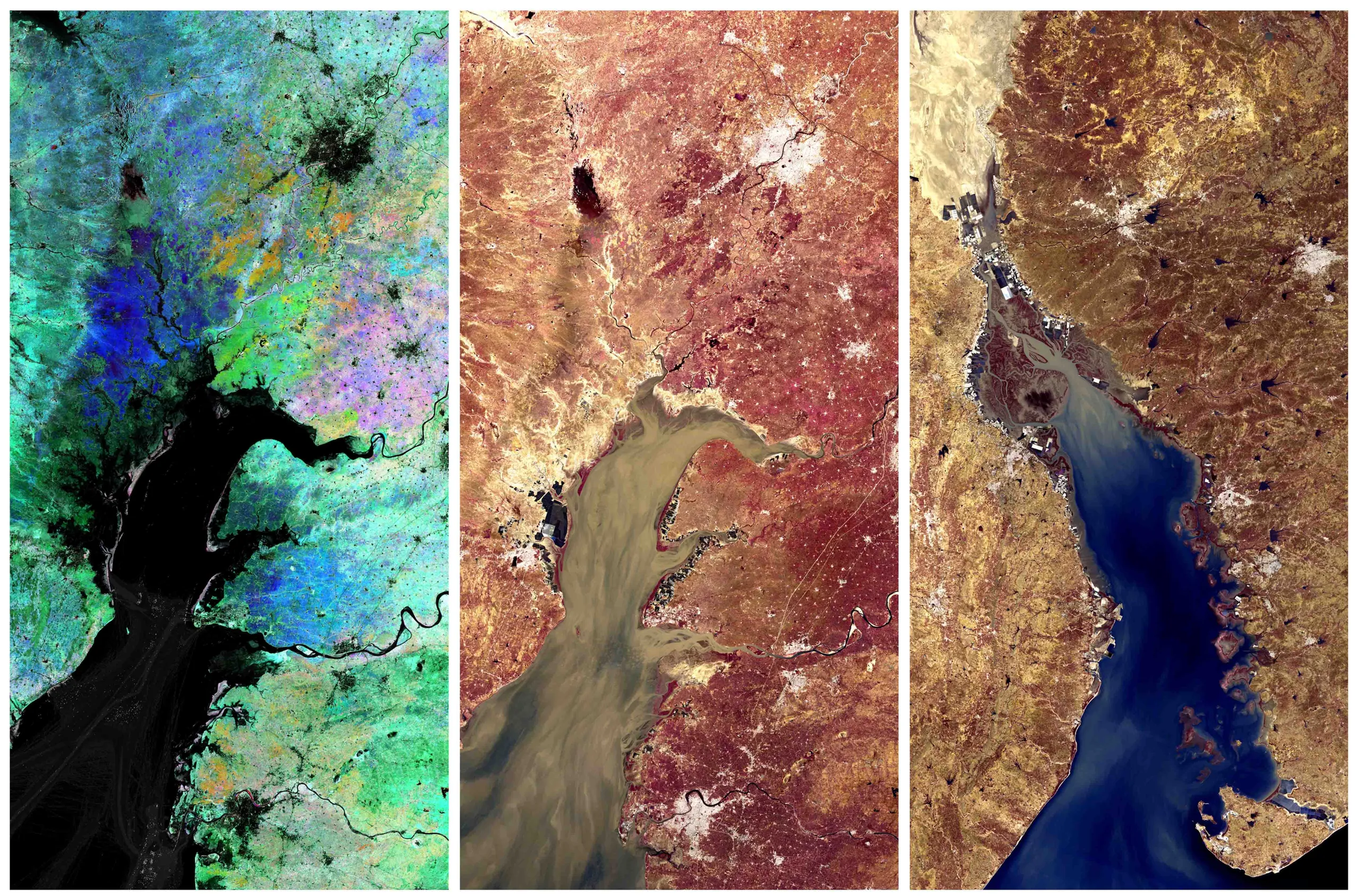
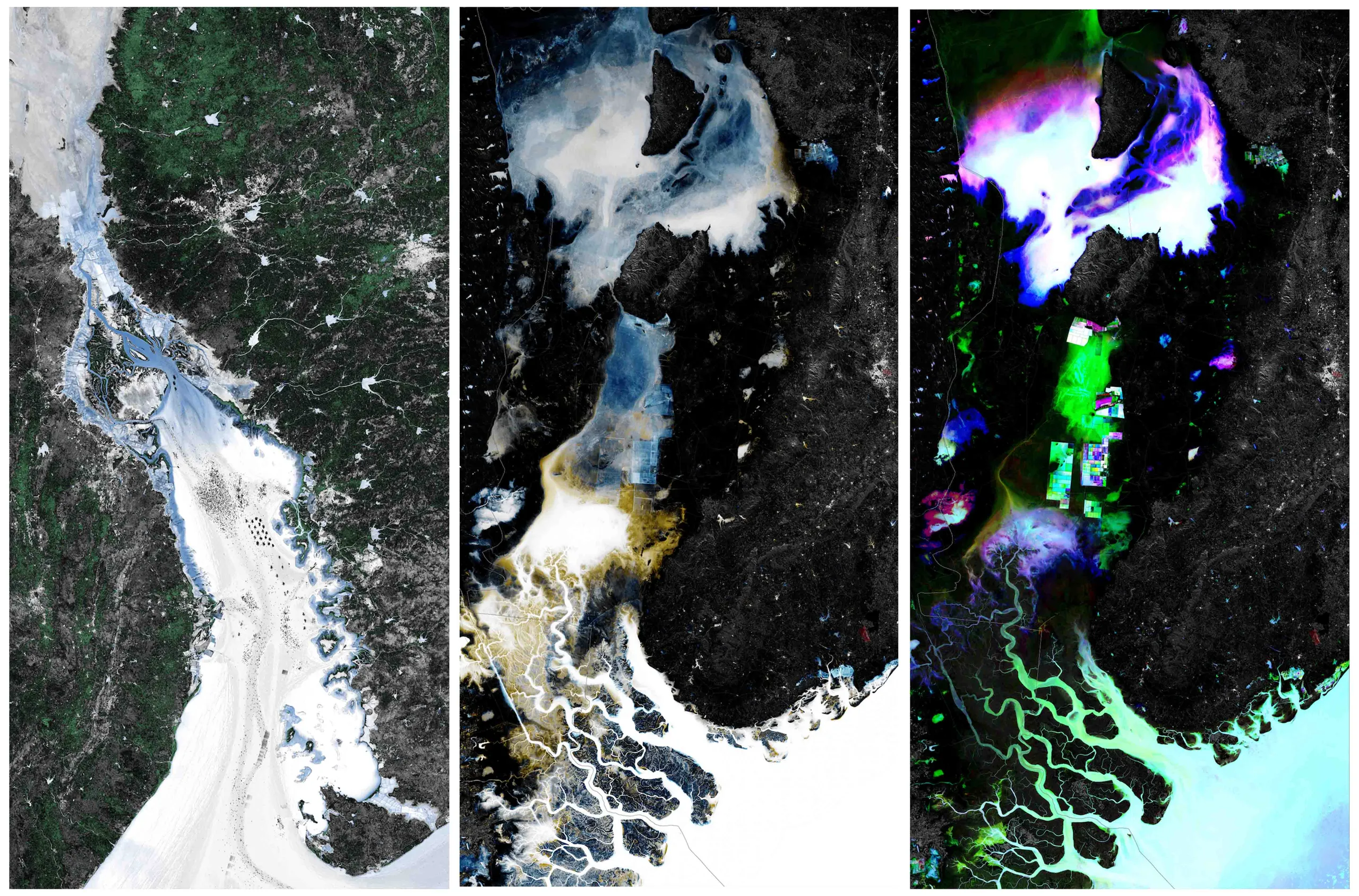
Turbulent displacements is a body of work that was displayed at Abhivyakti City Arts Exhibition held in November 2022 in Ahmedabad. The exhibit utilized remote sensing data and satellite imagery to analyze territorial transformations in Gujarat’s land and water systems. By integrating multi-source geospatial dataset- including OpenStreetMap, multi-spectral and multi-temporal Earth observation, radar satellite imagery, and topographic data, the project provided a comprehensive perspective of urbanization, industrial expansion, infrastructural interventions, and environmental shifts in the region.
Human activities in the Indian peninsula have transformed ecological, cultural, hydrological and energy systems, modifying these dynamic processes, in ways beyond our ability to conceptualise them. The project investigates the major shifts of rapid urbanisation, industrialisation, large infrastructural interventions and the effects of anthropogenic overheating in Gujarat. Turbulent Displacements captures remote sensing data and images that track various territorial transformations of our lands and waters.
Through shared images, it advocates for a new way of sensing and becoming sensitive to our environs, and contemplate on integrated, resilient, multiscalar and transdisciplinary approaches to the planning of our territories. The project composites data from various open source sensing platforms that include Open Street data, Multi Spectral and Multi Temporal Earth Observation, Radar satellite data topography data, and others, to visualise the large scale transformations happening in our immediate environment.